Tides, charts and passage planning: oral questions and answers.
48 questions from 13 lessons, with what a good answer covers. Most-asked first within each lesson.
Reading the answers is free. "Show me on the bridge" opens that moment in the simulator, with a pass.
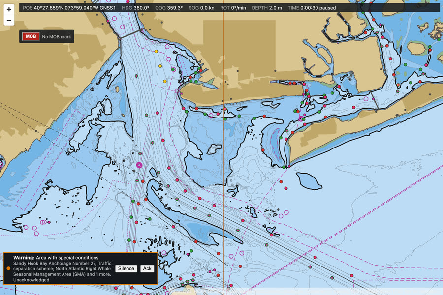
The chart table: the right chart, a position, a course and a DR
Take out the right paper chart, plot the GNSS position, lay off the course, run a DR ahead and check it against the position when the time comes.
Which chart should you be using, and how do you know it is fit to use?Often asked
A good answer covers:
- The largest-scale chart that covers where the ship is, as the passage plan lists them
- Corrected up to date from the latest notices to mariners, with the corrections recorded on it and in the chart correction log
- The latest edition, checked against the catalogue or the cumulative list
- Check the datum and units, and any notes, cautions and the source data diagram before relying on it
Show me on the bridgeThe chart table and the folio. Which chart covers where we are at the largest scale?
How are depths, heights and dangers shown on a chart, and where do you look a symbol up?Often asked
A good answer covers:
- Depths are soundings below chart datum, usually about the lowest astronomical tide; drying heights are underlined
- Heights of lights and land are above a high water level, so clearance under a bridge or a light's range must allow for the tide
- Wrecks, rocks and obstructions have their own symbols, with a dotted danger line round those that matter
- Every symbol and abbreviation is explained in Chart 5011, the INT 1 symbols booklet
What is the difference between a fix, a DR and an EP, and how do you mark each?Often asked
A good answer covers:
- A fix is an observed position, from position lines or a positioning system: a dot in a circle, with the time
- A DR is worked from a known position using the course steered and the speed through the water: a cross on the course line
- An EP also allows for the tidal stream and leeway: a dot in a triangle
- Each is labelled with the time, and the method for a fix
How do you measure a distance and lay off a course on a Mercator chart?
A good answer covers:
- Courses and bearings with a parallel ruler or plotter, from the compass rose or a meridian
- Distance with dividers against the latitude scale at the side, level with where you are measuring
- Never use the longitude scale for distance: a minute of latitude is a nautical mile, a minute of longitude is not
- Use a soft pencil and a soft rubber, so the chart survives the corrections and erasures
This week's notices: charts and publications
Work the whole weekly edition: correct the charts in ink or pencil, then the List of lights, the radio list and the pilot book, and record each.
What's in a weekly edition of notices to mariners, and how do you work through it?Often asked
A good answer covers:
- An index of the charts and publications affected, so you can see at a glance what you hold that needs work
- Chart corrections, permanent, and a separate section of temporary and preliminary notices
- Navigational warnings in force, and new charts and editions
- Work from the index against the folio and the books you hold, and record everything you do
Show me on the bridgeChart table, Notices to mariners: start with Section I, the index.
One notice changes a light. What do you correct?Often asked
A good answer covers:
- Every chart you hold that shows the light, as the notice names them
- The List of lights entry for that light, as a separate correction in that book
- Each correction recorded: in the chart log, and in the book's record of corrections
- Otherwise the chart and the book disagree, and the light may be misidentified at night
Which nautical publications would you expect to find on the bridge, kept up to date?
A good answer covers:
- Charts for the intended voyage, paper or ENC with its back-up
- Sailing directions, the List of lights and the list of radio signals
- Tide tables and tidal stream atlases, and the notices to mariners themselves
- The nautical almanac, the International Code of Signals and IAMSAR volume III
What are the annual notices, and why read them?
A good answer covers:
- Notices issued once a year, with standing information that does not change week to week
- Things like distress and safety communications, navigational warnings, and cables and pipelines
- They also explain how to correct the charts and books
- A new officer should read them when joining, and again when they are reissued
Chart corrections from notices to mariners
Apply this week's notices to the paper charts, ink or pencil as each needs, and log every one.
Talk me through correcting a paper chart from a notice to mariners.Often asked
A good answer covers:
- Check the notice applies to the chart and the edition you hold, and that the earlier notices for it are done
- Make the correction neatly at the exact position, using the standard chart symbols and abbreviations
- Write the notice number and year in the chart's small corrections margin
- Record it in the chart correction log, so anyone can see the folio is up to date
Show me on the bridgeThe chart table, with three notices to apply this week.
How do you handle temporary and preliminary notices?Often asked
A good answer covers:
- Mark them in pencil, so they can be rubbed out later
- Record them in the log as T or P notices
- Keep a list of those in force, and check it against the published list
- Rub them out when a later notice cancels them, or replace them when the permanent notice comes
How do you know the chart folio is up to date?
A good answer covers:
- SOLAS requires charts and publications adequate and up to date for the voyage
- The chart correction log shows the last notice applied to each chart
- Check it against the cumulative list for the editions and notices each chart should carry
- Check for new editions and new charts in the weekly notices
- Navigational warnings, NAVTEX and the radio cover what is too recent for a notice
A notice names three charts, and you hold two of them. What do you correct?
A good answer covers:
- Every chart you hold that the notice names
- Each correction logged against its own chart
- A chart you do not hold is not corrected, but check whether the passage needs it on board
Tidal calculations: UK standard and secondary ports
Work a Plymouth height, then a secondary port height and time, by the Admiralty method on the practice tables.
What is chart datum, and what are heights on a UK chart measured from?Often asked
A good answer covers:
- Chart datum is about the level of Lowest Astronomical Tide on UK charts: the tide rarely falls below it
- Charted depths are below chart datum, drying heights are above it (underlined on the chart)
- Depth of water is the charted depth plus the height of tide
What causes springs and neaps, and how do you use the range on the curve?Often asked
A good answer covers:
- Springs come a day or two after new and full moon, when the sun and moon pull together; neaps near the quarters
- Work out the day's range at the standard port and compare it with the spring and neap ranges
- Use the spring curve, the neap curve, or interpolate between them, on the standard port diagram
- Secondary port height differences are interpolated the same way, by the height of high or low water
Show me on the bridgeOpen the tide tables at the chart table. Today is between springs and neaps.
What is the rule of twelfths, and when would you not trust it?
A good answer covers:
- A quick estimate: in the six hours of rise, 1, 2, 3, 3, 2 and 1 twelfths of the range come in each hour
- Good enough for a check when the tide is regular and semidiurnal
- Not where the curve is odd, such as the Solent with its double high water, or Portland and Weymouth
- For a real clearance, use the tables and the curve for the port
How do you find the tidal stream at a place and time in UK waters?
A good answer covers:
- From the tidal diamonds on the chart: rate and direction each hour before and after HW at the reference port
- Or from the tidal stream atlas for the area, again by hours from HW Dover or a local port
- Interpolate between the spring and neap rates for the day's range
Tides at a diurnal port
One tide a day: work a height at Hon Dau and at a secondary port on the practice tables, with the twelve-hour curve.
What is the difference between a semidiurnal, a mixed and a diurnal tide?Often asked
A good answer covers:
- Semidiurnal: two high and two low waters a day, of much the same height, as round the UK
- Diurnal: one high and one low water a day, as in parts of the Gulf of Mexico and South East Asia
- Mixed: two tides a day of very different heights, or changing between semidiurnal and diurnal through the month
- At a diurnal port the range follows the moon's declination: largest at tropic tides, smallest at equatorial tides
Show me on the bridgeThe tide tables for Hon Dau: one high and one low water each day.
How does working a tide at a diurnal port differ from a semidiurnal one?Often asked
A good answer covers:
- The rise and the fall each take about twelve hours, so the factor curve runs about twelve hours either side of HW
- Use the curve published for that port, not a standard six-hour one
- The tables give one HW and one LW a day; check which of them is the tide you want, as it may fall on the next day
- Secondary port differences are applied the same way, by interpolation
What does a diurnal tide mean for planning a passage over a bar or a shallow patch?
A good answer covers:
- There is only one high water a day to cross on, so missing it can mean waiting a day
- The stream may run one way for many hours, and turn only once a day
- At equatorial tides the range is small, so there may be little gain from waiting
- Work the tidal window carefully and allow for squat, swell and a margin
A tidal window over a shoal patch
Work the height of tide the crossing needs and when it comes, a secondary port height by the factor curve, then cross with enough water.
How do you work out the height of tide you need to cross a shoal?Often asked
A good answer covers:
- Draught, plus the under keel clearance you need, less the charted depth
- The clearance from company or master's orders, more in a swell or when the survey is old
- Then find from the tables the times either side of high water that the tide is above that height
Show me on the bridgeThe 3 metre patch lies just north of us. We draw 3.9 metres.
Talk me through finding the height of tide at a secondary port at a given time.Often asked
A good answer covers:
- From the standard port tables, the times and heights of high and low water for the day
- Apply the secondary port differences, interpolating for the range, to get its own high and low waters
- Work out the time from high water and the range at the secondary port
- Enter the factor curve with the time from high water, read off the factor, springs or neaps as the range suggests
- Height is low water plus the factor times the range
Your tidal window is tight. What can make the real tide differ from the prediction?
A good answer covers:
- High pressure lowers the sea level, and low pressure raises it
- Strong offshore winds can hold the tide down, onshore winds can raise it
- Surges, river flow and seiches in some places
- Charted depths that have changed since the survey
- So leave a margin, cross near the middle of the window, and watch the echo sounder
The tidal stream atlas, and an EP
Find the atlas page for the coming hour, scale the rate for today, and lay an EP an hour ahead on the paper chart.
How do you use a tidal stream atlas?Often asked
A good answer covers:
- Find the time of HW at the reference port the atlas is based on, for the day
- Pick the page for the hour you want: each page covers about half an hour either side of its time
- Read the set from the arrow, and the rates at springs and neaps from the figures beside it, usually in tenths of a knot
- Interpolate the rate for the day from the day's range at the reference port against the mean spring and neap ranges
- Use the arrow nearest your position, and allow for the stream changing over the hours you are working
Show me on the bridgeTide tables, then Tidal stream atlas: the page for two hours before HW Sandy Hook.
What is the difference between tidal diamonds and a tidal stream atlas, and which would you use?
A good answer covers:
- Diamonds give the stream at one charted point, in a table on the chart, hour by hour from HW at a reference port
- An atlas shows the stream over a whole area, one page an hour, so you can see how it changes along the passage
- Both are predictions: wind, surge and river flow change the real stream, so check it with fixes
What is the difference between a DR and an EP?
A good answer covers:
- A DR is run on from a fix by course and speed through the water only
- An EP also allows for the tidal stream (and leeway): set and drift for the time run
- An EP is the best position you have without a fix, but it is only as good as the stream and the speed used
- Mark them with their own symbols and times on the chart, and confirm with a fix as soon as you can
IALA Region B: into the Ambrose Channel at dusk
Identify the safe water buoy, take her through the entrance gate and up the Ambrose Channel with every red buoy to starboard.
What is the difference between IALA Region A and Region B?Often asked
A good answer covers:
- Only the colours of the lateral marks differ; cardinal, isolated danger, safe water and special marks are the same
- Region B: red marks to starboard and green to port when going in the direction of buoyage, red right returning
- Region A: the reverse, red to port and green to starboard
- Region B covers the Americas, Japan, Korea and the Philippines; Region A most of the rest of the world
- Shapes are the same in both: can to port, cone to starboard, and numbers usually even on the starboard hand marks
Show me on the bridgeAhead, the safe water buoy, then the entrance gate: green buoy 1 to port, red buoy 2 to starboard.
What is the direction of buoyage, and how do you know it?Often asked
A good answer covers:
- Going in from seaward towards a harbour, river or estuary
- Elsewhere it is set by the authority and shown on the chart by a symbol where it might be in doubt
- Check the chart before relying on red and green
Describe a safe water mark, and what does it tell you?
A good answer covers:
- Red and white vertical stripes, a single red sphere topmark, a white light: isophase, occulting, one long flash every 10 seconds, or Morse A
- Safe water all round it: often the landfall or the centre line of a channel
- Ambrose buoy A shows Morse A
What is a preferred channel mark?
A good answer covers:
- Where a channel divides, it shows the preferred channel by its main colour and a broad band of the other
- It is treated like the lateral mark of its main colour; the preferred channel is on the other side
- Its light is composite group flashing (2+1) in the colour of the main band
IALA Region A: a practice channel and a preferred channel mark
Take her up a made-up Region A channel with every red buoy to port, then pass a preferred channel mark on the right side.
Describe the lateral marks in IALA Region A, by day and by night.Often asked
A good answer covers:
- Port hand marks are red, can shaped, with a single red can topmark if any, and a red light of any rhythm except composite group flashing (2+1)
- Starboard hand marks are green, conical, with a single green cone point up topmark if any, and a green light of any rhythm except (2+1)
- They are left on their own side going in the direction of buoyage: red to port, green to starboard
- Pillar or spar buoys keep the colour and topmark when they cannot take the shape
Show me on the bridgeAhead, the first gate of a made-up Region A channel: red can buoy 2 to port, green cone buoy 1 to starboard.
What does a preferred channel mark look like in Region A, and how do you pass it?Often asked
A good answer covers:
- Where a channel divides, it is the lateral mark of the main colour with one broad band of the other colour
- Preferred channel to starboard: red with a green band, can shaped, red light Fl(2+1); leave it to port
- Preferred channel to port: green with a red band, conical, green light Fl(2+1); leave it to starboard
- Either channel may be used, but the preferred one is the main channel
How do you know which buoyage region you are in, and what changes between them?
A good answer covers:
- Region B: North, Central and South America, Japan, Korea and the Philippines; Region A: the rest of the world
- Only the lateral marks change: in B red is to starboard going in, in A red is to port
- Cardinal, isolated danger, safe water, special and emergency wreck marks are the same in both
- Check the chart and the sailing directions, and the direction of buoyage, before relying on the colours
- A yacht crossing between regions should brief the change, as habit from the last region is a real risk
A clearing bearing past a wreck
Clear a dangerous wreck on a bearing of a charted light, check it as you pass, and find the set and drift of the stream.
What is a clearing bearing, and how do you set one up?Often asked
A good answer covers:
- A line of bearing on a charted mark that keeps the ship clear of a danger without fixing
- Drawn on the chart in advance, through the mark and clear of the danger with a margin
- Labelled not more than or not less than, with the dangerous side hatched
- The mark must be easily identified, and ideally well beyond the danger so the bearing changes slowly
- Check the bearing often as you pass, allowing for compass error
Show me on the bridgeThe wreck is four miles ahead, half a mile to port of the line. Find a mark to clear it on.
How do you tell whether a clearing bearing should be not more than or not less than?Often asked
A good answer covers:
- Imagine the ship on the dangerous side of the line and take the bearing of the mark from there
- If that bearing is greater than the clearing bearing, safe is not more than
- If it is smaller, safe is not less than
- Always check it on the chart; it is easy to get the wrong way round
How do you find the set and drift, and what do you use them for?Often asked
A good answer covers:
- Lay off a DR from a known position by course and speed through the water
- Fix the ship at a later time
- The set is the direction from the DR to the fix: where the stream is going
- The drift is the distance between them divided by the time, in knots
- Use it for the EP and the course to steer on the next leg, and compare with the tidal diamonds
Apart from a clearing bearing, how else can you keep clear of a danger in coastal waters?
A good answer covers:
- A clearing range or parallel index line on the radar
- A danger angle, vertical or horizontal, with the sextant
- A transit of two charted objects, which needs no compass
- A depth contour you must not cross, used with care
Plan the passage in from sea
Make and check the route on the ECDIS, work depths, clearance, reporting points and contingencies from the publications, and hand the plan to the master.
What are the stages of a passage plan? Tell me what goes in each.Often asked
A good answer covers:
- Appraisal: gather everything relevant from charts, notices, tide tables, lights, pilot book, radio list, weather and the ship's own condition
- Planning: the route on the chart, with courses, distances, safe depths, no-go areas, reporting points, abort points and contingencies
- Execution: timing, the tidal window, the expected weather and traffic, when to call the master or the pilot
- Monitoring: how and how often the position is fixed, parallel indexes, clearing lines, checks on the plan
- Berth to berth, approved by the master before sailing
Show me on the bridgeStopped east of the Ambrose buoy, waiting to go in. Look at the approach you will plan.
How do you work the under keel clearance and the no-go depth for a leg?Often asked
A good answer covers:
- Under keel clearance is the charted depth plus the height of tide relied on, less the draught
- It must be at least what the master or the company requires
- The no-go depth is the draught plus the clearance required, less the tide relied on
- Anything charted shallower than that is no-go, and is shaded or marked on the chart
- If you rely on the tide, you must also give the window it holds for
What is an abort point, and why does a plan need contingencies?
A good answer covers:
- The last point at which you can safely turn back or stop before committing to a narrow passage
- Chosen with the ship's turning circle and the depths and traffic in mind
- Contingencies cover failures and changes: an anchorage you can reach, an alternative route, emergency berths
- They are planned in advance, so the decision under pressure is already made
How do you decide the fix interval in pilotage waters?
A good answer covers:
- Often enough that the ship cannot run into danger between fixes
- Use more than one method, and cross check the ECDIS with radar and visual fixes
- Shorten it further near dangers, in poor visibility or with a strong cross stream
Bridge checks before departure
An hour before sailing: put the bridge right, from steering pumps to the course recorder, and tick the departure checklist.
What do you check on the bridge before the ship sails?Often asked
A good answer covers:
- Passage plan approved by the master and briefed, with charts, ENCs and publications up to date for the voyage
- Compasses: gyro and repeaters aligned, gyro and magnetic compass compared and the error known
- Radars, ECDIS with its safety settings for the draught, echo sounder, AIS voyage data, all checked
- Navigation lights, signals, VHF and internal communications tested; BNWAS on; course recorder and VDR running
- Engines and thrusters tested with the engine room, telegraphs and clocks compared, and the checks logged
Show me on the bridgeThe bridge as it was left in port, an hour before sailing.
What on the AIS do you change before sailing?
A good answer covers:
- Navigational status from moored to under way using engine
- Draught: the actual maximum draught for this voyage
- Destination and ETA
- Check the static data and the position source are right, and persons on board if the system holds it
What is the course recorder for, and what do you check on it?
A good answer covers:
- It traces the heading, and on many ships the rudder angle, against time, as a record of the course steered
- Used to check the steering afterwards: the helmsman, the autopilot, and after an incident
- Check it is switched on and running before sailing, with the time set right
Coastal passage on paper after both ECDIS fail
Get the position onto the paper chart, fix every 15 minutes, lay off an EP and a course to steer for the stream.
Both ECDIS fail on a coastal passage. What do you do?Often asked
A good answer covers:
- Note the time, and get the last good position onto the paper chart at once
- Take out the largest-scale chart held for where we are, with the route already on it
- Call the master, and keep the lookout and radar watch going all the while
- Fix often by more than one method: visual bearings, radar ranges, transits
- Consider slowing down, or standing further off, until the chartwork is settled
- Log it and report the defect
Show me on the bridgeThe chart table. Both ECDIS go dark two minutes in.
What makes a good visual fix?Often asked
A good answer covers:
- Three position lines rather than two, so a mistake shows up as a large cocked hat
- Marks well spread, so the lines cut at a good angle, never less than about 30 degrees
- Near marks before far ones: an angular error moves a far line further
- Take the bearings that change fastest, those near the beam, last
- A transit is the best line of all; a radar range is better than a radar bearing
- Identify each mark positively, and note the time of the fix
What's the difference between a DR and an EP?Often asked
A good answer covers:
- A DR is worked from the course steered and the speed through the water only
- An EP also allows for the tidal stream, and leeway where there is any
- The stream comes from the tidal diamond or atlas for the time, against high water at the standard port
- A fix compared with the DR at the same time gives the set and drift actually met
How do you work out a course to steer allowing for a tidal stream?
A good answer covers:
- Draw the ground track you want, from the position to the next waypoint
- From the start, lay off the stream vector for one hour: its set and rate
- From the end of the stream vector, swing an arc of one hour at your speed through the water to cut the track
- The line from the stream end to that point is the course to steer; then allow for leeway
- The point where the arc cuts the track also gives your speed over the ground
What counts as an adequate back-up for ECDIS?
A good answer covers:
- Whatever it is, it must let the voyage be finished safely if the main ECDIS fails
- The bridge team must be trained and practised in using it
See the lessons and a clip on the Passage planning page. Preparing for the OOW 3000 oral? See the syllabus, topic by topic.