Position fixing and compasses: oral questions and answers.
34 questions from 9 lessons, with what a good answer covers. Most-asked first within each lesson.
Reading the answers is free. "Show me on the bridge" opens that moment in the simulator, with a pass.
The compasses: gyros, repeaters and the magnetic compass
Find the heading changeover and the magnetic compass, line up a wing repeater, take a bearing, and change over when a gyro fails.
Compare the gyro compass and the magnetic compass. Why carry both?Often asked
A good answer covers:
- The gyro seeks true north, has a small and steady error, and feeds the autopilot, radar, ECDIS, AIS and repeaters
- But it needs power, takes hours to settle after starting, and has speed and latitude errors that need correcting
- The magnetic compass needs no power and cannot fail electrically, so it is the independent back-up
- But it points to magnetic north, so it carries variation and deviation, and it is disturbed by steel, cargo and electrical equipment
- SOLAS requires a magnetic compass on every ship covered, and a gyro on ships of 500 GT and over
Show me on the bridgeThe heading changeover panel and the compass projector at the helm.
Explain variation and deviation, and how you go from a compass course to a true course.Often asked
A good answer covers:
- Variation: the angle between true and magnetic north, from the chart, changing with place and slowly with time
- Deviation: the angle between magnetic north and where the compass points, caused by the ship's own magnetism, and changing with heading
- Compass error is variation and deviation combined
- Compass to true: apply deviation to get magnetic, then variation to get true; easterly errors are added, westerly subtracted
- Deviation comes from the deviation card, and is checked by comparison and by azimuth
The gyro feeding the autopilot fails. What do you do?Often asked
A good answer covers:
- Take hand steering if the autopilot has lost its heading, and steer by the magnetic compass if need be
- Change the heading source to the other gyro, or the magnetic heading, and check every receiver has it: autopilot, radar, ECDIS, AIS
- Remember radar stabilisation and ARPA are upset by a heading failure until the new source is in
- Call the master, log it, and tell the engineers or electro-technical officer
Before taking bearings at a wing repeater, what do you check, and why?
A good answer covers:
- That the repeater agrees with the master gyro heading: a repeater out of step puts its error into every bearing
- The known gyro error, so it can be applied to the bearings
- That the azimuth ring or pelorus turns freely and is level, and you can see the mark clearly
- Line the repeater up with the master if it has slipped, and report it
GNSS lost: fix by visual bearings
Both GNSS fail in the approach: acknowledge, take three quick bearings from the wing and fix the ship in the ECDIS.
You are in the approach and the ECDIS loses its GNSS position. What do you do?Often asked
A good answer covers:
- Acknowledge the alarm and note the time; the ECDIS is now running on dead reckoning
- Check the other receiver and the antenna feed before deciding it is a real loss
- Fix the ship at once by independent means: visual bearings, radar ranges, transits
- Enter the fix in the ECDIS as a manual fix so the DR restarts from a true position
- Shorten the fix interval, keep a good lookout, and call the master
- Warn other users of the position, such as the AIS, DSC and the radar, that their input is now poor
Show me on the bridgeBoth receivers stop a minute in. Watch the alarm and the position source change to DR.
How do you choose the marks for a three-bearing fix, and in what order do you take them?Often asked
A good answer covers:
- Charted, positively identified marks, ideally fixed lights or headlands rather than buoys
- Spread so the position lines cross well: about 60 degrees apart for three, near 90 for two
- Near marks rather than far ones, since an angular error moves the line less
- Bearings ahead or astern first, as they change slowly; the one near the beam last, as it changes fastest
- Take them quickly, note the time, and plot at once
Show me on the bridgeFrom the starboard wing, say which marks you would use and why.
Your three lines make a cocked hat. What does it tell you, and what do you do with it?
A good answer covers:
- A small triangle is normal; it comes from reading errors and the time between bearings
- A large one means a mark wrongly identified, a misread bearing or an unknown compass error
- Take the ship to be at the corner nearest the danger, not the middle
- Check the gyro error; a constant error turns all three lines the same way
- If in doubt, take a fresh set of bearings and fix again
What other ways are there to fix the ship near the coast without GNSS?
A good answer covers:
- Radar ranges of well defined charted features, which are usually more accurate than bearings
- Mixed fixes: a bearing and a range of the same or different marks
- Transits, which need no compass at all
- Running fix from one mark when only one is in sight
- Parallel indexing on the radar to monitor the track between fixes
- Soundings as a check, never as a fix on their own
Compass error by azimuth and amplitude
Find the gyro error from the sun, check the standard compass against it, log the comparison, and take an amplitude at sunset.
When do you check the compass error, and how?Often asked
A good answer covers:
- By azimuth of a celestial body, by amplitude at sunrise or sunset, or by a charted transit
- Gyro error first, then the standard compass by comparison with the corrected gyro
- Every result in the compass error book, and any change from the usual error looked into
Show me on the bridgeThe sun is low to the west. Stand at the repeater and look at it through the azimuth ring.
What is an amplitude, and when exactly do you take the bearing?Often asked
A good answer covers:
- The true bearing of the sun measured from east at rising or west at setting
- Found from the declination and the latitude, so no time or longitude is needed
- Taken when the sun's centre is on the celestial horizon
- Less reliable in high latitudes, where the sun rises at a shallow angle
Compass error, variation and deviation: how do they fit together?Often asked
A good answer covers:
- Compass error is the difference between true and the compass reading
- Variation is the earth's part, read from the chart for the place and year
- Deviation is the ship's own magnetism, and changes with heading
- Deviation is compass error less variation; compare it with the deviation card for the heading
- Going from compass to true, add easterly error and take off westerly
The gyro reads high. What does that mean for the bearings you take?
A good answer covers:
- A gyro that reads high has a westerly error, so subtract it to get true
- Every bearing off the repeater carries the same error until it is applied
- Apply it to bearings for fixes, and to the course set on the autopilot
- A sudden change in gyro error is a sign of a fault; compare with the magnetic compass
Compass error by a transit: the Sandy Hook range at dusk
Identify a pair of range lights, take a gyro bearing as they come in line, find the gyro error from the charted bearing, then check the standard compass.
Why is a charted transit a good way to check the compass?Often asked
A good answer covers:
- The true bearing is printed on the chart, so nothing has to be worked out
- It is quick and can be done whenever two charted marks come in line, by day or by night with range lights
- It needs no celestial body, so it works in overcast weather near the coast
- Error = charted bearing less the observed bearing; east if the charted bearing is greater
Show me on the bridgeThe two range lights to starboard: watch them close until one is above the other.
What makes one transit better than another for a compass check?
A good answer covers:
- The marks well apart compared with your distance from the front mark, so the line is sensitive
- Both marks positively identified, by chart, Light List and their characteristics
- Not so close to the front mark that a small error in timing gives a large error
- Taken at the moment they are exactly in line, and repeated if in doubt
How do leading lights help you keep a channel at night?
A good answer covers:
- The rear light is higher than the front; keep them in line and you are on the leading line
- If the front light opens to the right of the rear, you are to the right of the line; steer to bring them back in line
- Often sectored or of a limited arc, so they are only seen from near the line
- Check the bearing as well, so you know it is the right pair
You have found the gyro error. What next?
A good answer covers:
- Enter it in the compass error book with the time, position and method
- Apply it to every gyro bearing and course, and tell the next watch if it has changed
- Use the corrected gyro to find the standard compass error and the deviation, and compare with the card
- A change from the usual error is looked into and reported to the master
Vertical and horizontal sextant angles
Distance off a lighthouse by vertical sextant angle, and a station pointer fix from two horizontal angles.
How do you find your distance off a lighthouse with a vertical sextant angle?Often asked
A good answer covers:
- Measure the angle between the light and the shoreline or sea directly below it
- Correct the reading for index error
- Use the charted elevation of the light with tables or the formula to get the distance
- Plot it as a range circle round the light, and cross it with a bearing for a fix
- Good for distance off a danger: set a danger angle and keep the angle below it
Show me on the bridgeStopped east of Sandy Hook. Find a lighthouse with a charted height.
Explain a fix by horizontal sextant angles. When does it fail?Often asked
A good answer covers:
- Two angles between three charted marks, with a mark shared in the middle
- Each angle puts the ship on a circle through its two marks
- Set the angles on a station pointer, or plot the circles, and the ship is where they cross
- No compass is needed, so compass error does not come into it
- It fails when the ship and the three marks lie on one circle: the circles coincide and there is no cut
What are the sources of error in a vertical sextant angle?
A good answer covers:
- The base of the light is not always visible, especially when the shore is far off
- Height of eye matters little when close, but adds error when the object is near the horizon
- Index error not applied
A day's work by the sun: sun-run-sun
Index error, a morning sun sight worked and plotted, the noon latitude, and the morning line run up to a noon fix.
How do you find and apply the index error of a sextant?Often asked
A good answer covers:
- Set the arc near zero and look at the horizon, or a star, through the telescope
- Turn the drum until the direct and reflected horizons make one straight line
- The reading is the index error: on the arc means it reads high, so subtract it
- Off the arc means it reads low, so add it
- Check it before every set of sights, as it can change
Show me on the bridgeClear sky and a good horizon. Open the sextant and find the index error first.
Talk me through working a morning sun sight by the intercept method.Often asked
A good answer covers:
- Note the deck watch time, correct it to UTC with the deck watch error
- From the almanac, the GHA and declination for that UTC
- Choose an assumed position, and find the LHA from the GHA and the longitude
- Correct the sextant altitude for index error, dip, refraction and semi-diameter to get the true altitude
- Calculate the altitude and azimuth for the assumed position
- The difference is the intercept: towards the sun if the true altitude is greater, away if less
- Plot from the assumed position along the azimuth, and draw the position line at right angles
How do you get latitude from the noon sight?Often asked
A good answer covers:
- Work out the time of meridian passage at the ship beforehand from the DR longitude
- Start taking altitudes a few minutes before, and take the greatest as the sun stops rising
- Correct it to the true altitude; the zenith distance is 90 degrees less the true altitude
- Latitude is the zenith distance combined with the declination, by their names
- No sight reduction is needed, which is why it is so useful
How do you run the morning position line up to noon, and what can go wrong?
A good answer covers:
- Move the line parallel to itself by the course and distance made good between the sights
- Cross the transferred line with the noon latitude for the noon fix
- Any error in the course or speed made good, from tide or leeway, goes straight into the fix
- Best when the two lines cross at a good angle, so the morning sight is taken with the sun well round from south
Fixing by radar ranges, and a running fix
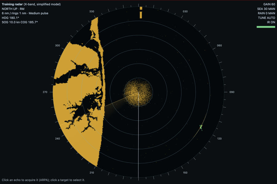
Both GNSS fail: fix by radar ranges of charted marks on the ECDIS, then a running fix, and log it.
Why are radar ranges better than radar bearings for a fix?Often asked
A good answer covers:
- Bearings suffer from the horizontal beam width, which widens the echo, and from heading and gyro errors
- So ranges from two or three marks give the best radar fix; a bearing can be added as a check
- Use the VRM on the nearest edge of the echo, on a range scale that puts the mark well out from the centre
Show me on the bridgeFind buoys S and 4 on the radar. Which edge of each echo would you range on?
How do you choose marks for a radar fix, and what can go wrong?Often asked
A good answer covers:
- Charted, radar-conspicuous objects whose position is certain: a racon, a light structure, a steep headland, a small rock
- Avoid low, sloping coasts where the radar edge is not the charted coastline
- Buoys can be off station, so check them against other marks
- Two marks about 90 degrees apart give the best cut; three marks show up a mistake as a cocked hat
- Make sure you have identified the echo: compare the picture with the chart
What is a running fix, and what are its weaknesses?Often asked
A good answer covers:
- A position line taken earlier is run on along the course and distance made good to the time of a second line, and the fix is where they cross
- Useful when only one mark is in sight or on the radar
- Its accuracy depends on the course and speed used to run the first line on
- An unknown set and drift moves the fix, so it is less reliable than a fix from simultaneous lines
Both GNSS fail in a channel approach. What do you do?
A good answer covers:
- Acknowledge the alarm and confirm the ECDIS is in dead reckoning, using the gyro and the log
- Fix at once by radar ranges and visual bearings, and keep fixing at short intervals
- Use parallel indexing on the radar to keep the track
- Call the master, consider slowing down, and inform VTS if in an area that has one
- Log the failure, the time and each fix
Leeway in a running fix
A near gale on the beam: find the leeway, take two bearings ten minutes apart, and run the first on along the water track.
What is leeway, and how do you allow for it?Often asked
A good answer covers:
- Leeway is the angle between the heading and the track through the water, caused by the wind pushing her sideways
- It is downwind of the heading: with the wind on the starboard side she makes leeway to port
- It grows with the wind strength and the windage, and is larger at low speed
- Estimate it from the wake against the fore and aft line, or from heading and COG when there is no stream
- Allow for it in the course to steer, by heading upwind of the track wanted
Show me on the bridgeCompare the heading and the COG on the Ship tab: no stream here, so the difference is leeway.
In a running fix, along what do you run the first position line on?Often asked
A good answer covers:
- Along the course and distance made good between the two observations
- With leeway, that is the water track, the heading allowing for leeway, not the heading itself
- With a stream as well, allow for the set and drift: run it on along the ground track
- The distance is the speed made good times the interval, from the log corrected for the stream
- A running fix is only as good as the course and speed used, so label it and fix by other means when you can
Why does a motor yacht make so much leeway, and when does it matter most?
A good answer covers:
- High topsides and superstructure give a large area to the wind, with a shallow draught to resist it
- At low speed the wind has more effect relative to the water flow over the hull
- It matters most in confined water, when berthing or anchoring, and when running a fix or a DR over a long time
A light rising and dipping: Sandy Hook on a clear night
Work out a rising range, watch the light rise from the monkey island, see it dip from the bridge wing, and fix her by the rising range and a bearing.
What are the nominal, luminous and geographical ranges of a light?Often asked
A good answer covers:
- Nominal range: the luminous range in a meteorological visibility of 10 miles; the range on the chart in most countries
- Luminous range: how far the light can be seen in the visibility at the time, from its intensity; found from the luminous range diagram
- Geographical range: how far it can be seen over the curve of the earth, from the height of the light and the height of eye
- You see it at the lesser of the luminous and the geographical range
Show me on the bridgeFine on the starboard bow, Sandy Hook Light is still below the horizon. Watch for it to rise.
How do you work out the rising range of a light?Often asked
A good answer covers:
- Distance to the horizon from the light plus distance to the horizon from the eye
- Each is about 2.08 times the square root of the height in metres, in nautical miles, with normal refraction
- Or from the geographical range table in the List of Lights
- Here: 2.08 times root 26.8 plus root 15.6, about 19.0 miles from the monkey island
How far can you trust a rising or dipping range for a fix?
A good answer covers:
- Only roughly: abnormal refraction can move it by a mile or more
- The light's height is above high water (MHWS, or MHW on US charts), so at lower tides it rises a little sooner
- Only if the luminous range is greater than the geographical range in the visibility at the time
- Bob the light: lower your eye, and if it dips it is just on the horizon
- Confirm with another position line as soon as you can
What is the loom of a light?
A good answer covers:
- The glow of a powerful light reflected off the haze or cloud above it before the light itself is above the horizon
- It shows the light's bearing early, but not its range: wait for the light itself before using a rising range
- A loom can be seen well beyond the geographical range, so it is a help to identification, not a position line by range
See the lessons and a clip on the Position fixing page. Preparing for the OOW 3000 oral? See the syllabus, topic by topic.